People in the US state of Louisiana have been warned to prepare for the arrival of a hurricane, according to BBC News.
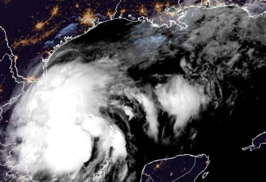
Tropical Storm Francine has formed in the Gulf of Mexico with sustained winds estimated at 50mph (85km/h).
Forecasters at the National Hurricane Center, external are expecting the storm to intensify as it drifts north-eastwards, fuelled by very warm waters - with sea surface temperatures of more than 30C (86F).
Francine is predicted to be at hurricane strength before making landfall on Wednesday.
A hurricane watch has been issued for the coast of Louisiana, with the risk that sustained winds could reach 85mph (136km/h) before Francine moves onshore. This would make it a category one hurricane.
Low-lying coastal areas could be inundated by a storm surge of up to 10ft (3m).
Rain is expected to be another feature of the storm, with 4-8in (100-200mm) forecast in coastal parts of north-east Mexico, Texas and Louisiana. The very wettest places could see up to 12in (300mm) of rain, bringing the risk of significant flooding.
This area is no stranger to hurricanes. Hurricane Ida made landfall in 2021 as the fifth most powerful storm on record to hit the US mainland, while Hurricane Katrina killed 1,800 people back in 2005.
More recently, Hurricane Beryl brought damaging winds, flooding and power cuts to parts of Texas and Louisiana, leading to a number of deaths.
The Atlantic hurricane season runs from June until November - with early September typically representing the peak of storm activity.
But despite forecasts of an "extremely active" hurricane season the last few weeks have brought the longest lull in storm activity in more than 50 years, with no storms developing since mid-August.
Scientists at Colorado State University, external have suggested a number of reasons for this.
One key factor is unusual weather patterns across Africa that have brought rain to parts of the Sahara that rarely see wet weather.
It means the thunderstorms that normally fuel Atlantic hurricanes have been further north than usual, in areas where strong winds high in the atmosphere can tear developing storms apart.
The delayed arrival of La Niña and large amounts of Saharan dust in the atmosphere may also have played a part.
But an above average season overall is still predicted with activity expected to increase in the coming weeks.